What’s actually slowing this PC down?
Pick the symptom - the matching free tool is one click away.
Shipstern Bluff—known locally as “Shippies”—is a remote surf break near Cape Raoul on the south-western coast of Tasmania’s Tasman Peninsula, within the Tasman National Park area. Parks and Wildlife Service Tasmania describes it as one of the world’s most dangerous surf locations. Its reputation rests on a combination of powerful big-wave conditions, a distinctive reef “step,” an exposed coastline and difficult access. There is no reliable published figure in the available park and tourism material for the break’s maximum wave height, reef depth or incident rate.
That distinction matters. The danger is well established descriptively, but it should not be represented with invented measurements or an unsupported fatality count. Visitors and surfers need to treat every access description as approximate and check current park, road, tide, weather and ocean information before travelling.
Where exactly is Shipstern Bluff?
Shipstern Bluff sits near Cape Raoul on Tasmania’s Tasman Peninsula, in the state’s far south-east. The coast is part of the Tasman National Park area, a large protected landscape reached from the Hobart region by the Arthur Highway.
The break is not a town, beach resort or roadside lookout. It is a remote section of rocky coastline associated with Cape Raoul. Regional tourism material uses “Shippies” as the local shorthand, while Parks Tasmania and the park’s management plan use Shipstern Bluff or Ship Stern Bluff.
#1 Best Overall

- Soft Foam Construction Classic Surfboard, strong EPS core with 3 stringer system
- Soft WBS-IXL ( Water Barrier Skin ) crosslink top deck and rails High Density (HDPE) Polyethylene slick bottom skin Exclusive New Color Graphic art deck
- Included removable bolt thru fins ankle leash traction pad
- Dimensions 8' x 22 1/2" x 3 1/4" Weight 11.5 lbs
- Volume 86 liters
Parks Tasmania says Tasman National Park is about a 90-minute drive from Hobart via Sorell and the Arthur Highway. That is a park-level travel estimate, not a guaranteed drive time to the surf break itself. The park page identifies Highcroft Road as the turnoff for the south-western park area; Highcroft Road becomes Stormlea Road. Road surfaces, closures, traffic, weather and the final walking or marine approach can all make the total journey longer.
| Question | What the available sources establish |
|---|---|
| State and region | Tasmania’s far south-east, on the Tasman Peninsula |
| Nearby landmark | Cape Raoul |
| Protected area | Tasman National Park area |
| Local shorthand | “Shippies” |
| Hobart travel context | About 90 minutes to Tasman National Park via Sorell and the Arthur Highway, according to Parks Tasmania |
| Road approach named by Parks Tasmania | Arthur Highway to Highcroft Road, which becomes Stormlea Road |
How do people reach the coastline?
There is no simple, universally suitable route to Shipstern Bluff. The sources describe both a land approach associated with the Cape Raoul walk and a long approach from the water. These are descriptions of access options, not real-time directions or a recommendation that any particular visitor attempt them.
Road and walking approach
- From Hobart, follow the general route through Sorell and along the Arthur Highway toward the Tasman Peninsula.
- For the south-western section of Tasman National Park, use the Highcroft Road turnoff identified by Parks Tasmania; the road continues as Stormlea Road.
- Check the current park access notices before leaving the main road. Track closures, road damage, fire restrictions, heavy rain and other changes can alter the route.
- Regional tourism information describes a four-hour return walk from the main road as one way of reaching the area. Treat that duration as an estimate, not a timetable. A walk of that length requires enough daylight, water, footwear and weather margin for the return trip.
Another regional description says that, at low tide and in calm conditions, the Cape Raoul walk reaches rocky coastline and the reef’s “step.” That wording does not mean every tide or sea state permits a safe descent to the waterline. A rocky coast can become impassable when waves, swell or surge increase, and low tide alone does not remove those hazards.
Boat or jet-ski approach
Discover the Tasman Peninsula describes an approach of about 30 kilometres by boat or jet ski. The figure is a source-described estimate, not a surveyed route length or a promise of a landing point. Marine access depends on a suitable vessel, competent operator, launch arrangements, weather, swell and the ability to remain clear of breaking surf and rocks.
Rank #2
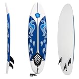
- [Enhanced Control with Detachable Fins]: Engineered for agility and control, this surfboard features a tri-fin setup that boosts maneuverability and directional stability. Whether you're carving through waves or maintaining balance on turns, the fins enhance responsiveness. After use, you can simply detach the fins for more compact storage and hassle-free transport.
- [Premium Materials for Optimal Performance]: Ride confidently on our slip-resistant EPE deck, offering exceptional grip and impact-resistant durability. The PP bottom reduces drag for faster gliding, while dual integrated fiberglass rods provide core reinforcement—ensuring responsive speed and long-lasting resilience in diverse water conditions.
- [Great for All Skill Levels]: With its generously sized 72"x20"x3" platform, this foam surfboard delivers enhanced buoyancy for effortless balance and easier takeoffs. Complete with a safety ankle leash, the beginner board accommodates teenagers and adults, making it perfect for beginners, surfing enthusiasts, family sharing, or as a reliable backup board.
- [Lightweight & Versatile Design]: At just 4.9 lbs, this surfboard can be effortlessly transported to beaches, surf breaks, or water yoga sessions. Its vibrant aesthetics command attention on the waves, ideal for both safety and style. After its surfing life, creatively repurpose the board as striking wall decor or a functional outdoor rack, extending its utility and value beyond the water.
- [Hassle-Free Setup & Reliable Support]: Get wave-ready in seconds with our tool-free fin installation, and ensure the best fit by checking dimensions before purchase. Designed to securely support riders up to 110 lbs, this board is backed by our dedicated customer service team, guaranteeing your complete satisfaction from the initial use to all your future adventures.
Parks Tasmania also says the park can be experienced from the water by tour boat or kayak. That general visitor information does not verify a particular operator, departure point or service that lands at Shipstern Bluff. Anyone considering a water trip should confirm current operator availability, permissions, marine forecasts and landing restrictions independently.
Access figures at a glance
| Option | Figure or description | Important qualification |
|---|---|---|
| Drive from Hobart to the park region | About 90 minutes | Parks Tasmania estimate for Tasman National Park, not the complete journey to the break |
| Walk from the main road | About four hours return | Regional tourism estimate; duration varies with conditions, route and pace |
| Boat or jet ski | About 30 km | Regional tourism description; route and landing depend on marine conditions |
| Cape Raoul walk and shoreline | Reaches the rocky coast and “step” at low tide in calm conditions | Not a guarantee of safe shoreline access in swell or rough weather |
What makes Shipstern Bluff’s waves so dangerous?
It is a recognised big-wave break
The Tasman National Park and Reserves Management Plan (2011) says Ship Stern Bluff has become renowned for “big wave” surfing. Parks Tasmania’s current park description goes further, calling it one of the most dangerous surf locations in the world. Those statements establish the break’s status and reputation without assigning a specific wave-size threshold.
Big-wave surfing involves substantially more energy than ordinary beach or reef surfing. A breaking wave can move a surfer rapidly, drive them underwater and make recovery time critical. At Shipstern Bluff, the remote setting means that a problem in the water is not taking place beside a lifeguarded urban beach. The practical consequence is that surfers and observers must plan for self-reliance, delayed assistance and a difficult evacuation rather than assuming immediate rescue.
The reef has a distinctive “step”
Regional tourism material singles out a reef “step” as the feature that gives the wave its distinctive appearance. The sources do not provide a bathymetric survey, a measured depth or a technical account of the exact way the reef geometry shapes each section of the wave. It is therefore more accurate to describe the step as a documented reef feature associated with the break than to claim a precise breaking mechanism.
Outdated Drivers Are Slowing You Down
One free scan finds every outdated or missing driver and matches the right update for your exact hardware.Free scan · exact hardware matchPC Slower Than It Used to Be?
A free scan shows the junk files, broken settings and background clutter dragging Windows down - then fixes them in one click.Free scan · Windows 10 & 11Rank #3

- Soft foam construction// EPS core with 3 Stringer System
For a surfer, a sudden change in reef contour can make a wave’s shape and depth change over a short distance. At a powerful break, that kind of abrupt transition can reduce the margin for choosing a line, timing a takeoff or recovering after a fall. The available sources support the existence of the step and the break’s big-wave reputation; they do not justify a numerical model of the reef.
Exposure and remoteness amplify consequences
Shipstern Bluff is on an exposed, rocky coast reached by a long walk or a substantial marine journey. Access is not a short stroll from a road with regular emergency services. Distance, terrain and changing sea conditions can complicate every stage of an incident: reaching a person in the water, getting them ashore, moving them along the track and arranging transport out of the park.
This is why “dangerous” should not be read only as a description of the wave face. The combination of wave energy, reef environment, open-coast exposure and remoteness creates a high-consequence setting even when no incident statistic is available.
Conditions can change the character of the break
A regional tourism page says the best times to view the large wave are often autumn and winter, when swell comes from the south and wind comes from the north. That is a general seasonal description, not a forecast or guarantee that every autumn or winter day will produce surf. Swell direction, wind, tide and local weather can change quickly, and a day that looks suitable for viewing may not be suitable for entering the water.
Quick wins for a faster PC:
Scan for outdated or missing drivers - takes under a minuteDriver Scan →Clear out junk files and repair common Windows errorsFree Scan →Rank #4
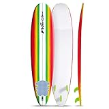
- Soft Foam Construction Classic Surfboard, strong EPS core with 3 stringer system
- Soft WBS-IXL ( Water Barrier Skin ) crosslink top deck and rails High Density (HDPE) Polyethylene slick bottom skin Exclusive New Color Graphic art deck
- Included removable bolt thru fins ankle leash traction pad
- Dimensions 8' x 22 1/2" x 3 1/4" Weight 11.5 lbs
- Volume 86 liters
What is known—and not known—about the risk?
Clear language is important because dramatic surf locations often attract unsourced numbers. The material available for Shipstern Bluff supports some conclusions and leaves others open.
| Established by the sources | Not established by the sources reviewed |
|---|---|
| Shipstern Bluff is associated with big-wave surfing. | A maximum or average wave height. |
| Parks Tasmania calls it one of the world’s most dangerous surf locations. | A reef-depth measurement or detailed bathymetry. |
| A distinctive reef “step” is identified by regional tourism material. | An incident, injury or fatality total. |
| The site is remote, rocky and reached by long land or water approaches. | A quantified probability of injury or a ranking based on measured risk. |
| Autumn and winter, south swell and north wind are described as favourable viewing circumstances. | A forecast for any particular date, tide or surf session. |
Accordingly, claims about a precise number of deaths, a guaranteed wave height, a particular reef depth, water temperature or a special animal hazard should not be attached to Shipstern Bluff unless a current, authoritative source supplies them. The absence of a published number does not make the location safe; it means the risk should be explained through the documented physical and logistical features rather than invented statistics.
How should a visitor plan a viewing trip?
Check the park before travelling
- Confirm that the relevant roads and tracks are open and identify any fire, storm, maintenance or conservation closures.
- Check the current parks-pass requirement. Parks Tasmania says a valid parks pass is required for the park.
- Review the tide, marine forecast, swell, wind and daylight window. The “low tide and calm conditions” description for reaching the rocky coast is conditional, not a standing access rule.
- Allow time for the return journey. A four-hour return walk estimate leaves little margin if the party starts late or conditions deteriorate.
- Tell someone the planned route and return time, and carry communication and navigation equipment appropriate to a remote national-park walk.
Choose a viewpoint, not an improvised water entry
Seeing a large wave from land or from a properly operated boat is a different activity from surfing it. Stay on stable ground, away from the edge of wet rock and surge channels, and do not move closer merely because the sea appears calm for a few minutes. On the water, use a competent operator and follow instructions about approach distance and landing. The available descriptions do not identify a universally safe lookout, so conditions and local park guidance should determine where you stand.
Respect the protected setting
Tasman National Park is a protected area. Keep to authorised tracks, carry out rubbish, avoid damaging vegetation or reef habitat and follow any seasonal restrictions. A dramatic surf location is still a conservation site, not an informal stunt venue.
Why the “dangerous” label is justified without a wave-height statistic
Risk descriptions do not always require a single headline number. In this case, several independently described characteristics point in the same direction: a break renowned for big-wave surfing, a reef step that gives the wave its unusual form, an exposed rocky coastline and access that may involve a long walk or a 30-kilometre marine approach. Parks Tasmania’s explicit wording—“one of the most dangerous surf locations in the world”—is a professional park-management description, while the 2011 management plan documents the site’s big-wave reputation.
Those sources support a careful conclusion: Shipstern Bluff is dangerous because high-energy surf meets a reef feature and a remote, difficult-to-access coast. They do not support pretending that the danger can be reduced to an exact wave height, depth or incident rate.
Quick Recap
Quick reference
- Where: Near Cape Raoul on the south-western Tasman Peninsula in Tasmania’s Tasman National Park area.
- Local name: Shippies.
- Why famous: A renowned big-wave surf break with a distinctive reef “step.”
- How dangerous: Parks Tasmania describes it as one of the world’s most dangerous surf locations; remoteness and difficult access increase the consequences of an accident.
- Access described by tourism sources: About a four-hour return walk from the main road or roughly 30 kilometres by boat or jet ski; the Cape Raoul walk reaches the rocky coast at low tide in calm conditions.
- General viewing season described: Often autumn and winter, with south swell and north wind—never a substitute for a current forecast.
- Before setting out: Check park access, track and road status, tides, weather, swell, daylight and parks-pass rules.
Product prices and availability are accurate as of the date/time indicated and are subject to change. Any price and availability information displayed on Amazon at the time of purchase will apply.






Say something about this film