Archaeologists identify a lagoon aircraft wreck by combining historical loss records with several sensors, then confirming the strongest clues with controlled diver or remotely operated vehicle (ROV) inspection. Side-scan sonar and multibeam mapping locate and outline targets; magnetometers can reveal buried ferrous parts; overlapping photographs, measurements and photogrammetry create a scaled record. The aircraft’s configuration, engines, armament, markings, serial numbers and debris-field pattern are then tested against archival records.
This sequence matters because lagoons often have shallow water, shifting currents, heavy turbidity and biological growth. A diver may see only a few centimetres ahead, while sonar can still show the shape and extent of a contact. Documentation is completed before anything is moved, excavated or recovered.
Identification starts with a historical target, not a random sonar mark
Before a boat leaves the dock, the team defines what aircraft it is seeking and why that aircraft could be in the lagoon. Researchers assemble crash reports, sortie and accident records, military unit histories, navigation charts, previous survey notes and local accounts. These records are used to predict a search area and to set expectations about the likely depth, heading, impact direction and debris spread.
Professional projects normally operate under a written research plan and qualified supervision. Naval History and Heritage Command (NHHC) guidance treats the plan as a prerequisite: it sets the questions, methods, safety controls, recording standards and decision rules for investigating a contact. A search that begins without this framework can collect attractive images but still fail to establish identity or preserve useful context.
Recommended Free Tools
#1 Best Overall
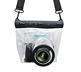
- Universal Compatibility: Designed for a wide range of DSLR, this Zonman waterproof case or bag fits most models of Canon, Nikon, Sony camera bodies. Perfect for cameras with a lens length up to 13cm or 5.12" and a diameter of 8cm or 3.15" , ensuring a secure fit for your valuable equipment. fit for cameras with lens not longer than 5.12'' like ::Canon Rebel T Series 80D 90D 55D 650D 750D 800D 6DMarkII 7DMarkII Nikon D90 D500 D610 D810 D850 D D3500 D5100 D5200 D5300 D5500 D5600 D7500 etc, or similar size.
- Easy Camera Function Access: Though fully enclosed for maximum protection, our housing case or bag features strategically placed finger holes, allowing effortless access to crucial camera functions like shutter release and zoom and focusing. Capture stunning underwater and wet-weather shots with ease.
- Ultimate Protection: Whether you're caught in rain, snow, or a sandy beach, our underwater housing case or bag shields your camera from the elements. Its complete seal locks out water, moisture, dust, mud, and sand, offering unparalleled protection in any environment.
- Dive Deep into Adventure: With an underwater depth capacity of approximately 5 meters or 16 feet, this case is ideal for a variety of water sports including diving, rafting, surfing, snorkeling, and swimming. Capture stunning underwater shots without worrying about water damage.
- Versatile Outdoor Use: Not just for water-based activities, this housing is also perfect for fishing, boating, and other outdoor pursuits where your camera might be exposed to harsh conditions. Enjoy peace of mind knowing your gear is safe from the elements.
What the historical file contributes
- Time and place: A last-known position, route, weather report or charted hazard narrows the probable area.
- Aircraft characteristics: Model, engine arrangement, armament, landing gear, float or wheel configuration and national markings provide a checklist for later inspection.
- Loss circumstances: A crash on impact, a ditching, a forced landing or a post-crash breakup produces different debris patterns.
- Unique identifiers: Bureau numbers, serial numbers, unit codes and modifications can turn a probable identification into a defensible one.
The historical file does not prove that a particular sonar contact is the aircraft. It defines a testable hypothesis that the sensors and site evidence must support.
Which sensors find aircraft wrecks in lagoon conditions?
No single instrument works best for every lagoon. Teams combine broad-area acoustic coverage with targeted metal detection, then use close-range imaging for interpretation. The practical differences are summarized below.
| Method | Area coverage | Turbidity and low visibility | Buried versus exposed material | Position and 3D detail | Operational considerations |
|---|---|---|---|---|---|
| Towed side-scan sonar | Efficient swaths over broad seabed areas | Unaffected by optical visibility; outlines acoustic shadows and texture | Best for exposed or shallowly covered wreck structure; not a dedicated burial detector | Strong plan-view image when navigation and tow height are controlled; limited height information | Requires careful line planning, stable tow speed and repeat passes over ambiguous contacts |
| Multibeam echosounder | Systematic bathymetric coverage | Works when water is too cloudy for cameras | Shows seabed relief; burial itself may require another sensor | Provides depth and relief that can be combined into a terrain model | Sound-speed measurements, vessel motion and tide corrections affect accuracy |
| Magnetometer or gradiometer | Searches lanes for magnetic anomalies | Not dependent on light or water clarity | Can detect ferrous engines, guns and structural components beneath sediment | Locates an anomaly; does not by itself produce a visual or 3D wreck model | Nearby anchors, pipelines, cables and other metal can create false positives |
| Sub-bottom profiler | Profiles sediment along survey lines | Useful in dark or turbid water | Examines objects and layers below the seabed | Provides vertical profiles rather than a complete wreck image | Penetration and resolution vary with sediment type and acoustic frequency |
| Autonomous underwater vehicle (AUV) | Repeats programmed lanes with consistent spacing | Can carry acoustic sensors without a surface tow cable | Depends on its payload; can combine sonar and other instruments | Accurate navigation and dense data are possible when the mission is well planned | Needs specialist mission planning, recovery procedures and processing |
| ROV and diver inspection | Small area, selected from survey contacts | Lights and cameras work at close range, but suspended sediment can still obscure details | Directly observes exposed parts; probing or excavation requires separate authorization | Supplies diagnostic imagery and measurements when position and camera orientation are logged | Subject to depth, current, entanglement, gas, decompression and conservation risks |
The National Park Service assessment of submerged cultural resources notes that mechanical scanning sonar can document complex sites efficiently in low-visibility settings when the survey design and goals are realistic. In practice, sonar finds and outlines a candidate; an ROV or diver supplies the evidence needed to interpret it.
A step-by-step lagoon workflow
- Define the target and write the plan. Assemble the loss file, plot the predicted area and specify what would count as a meaningful result. Set safety, permitting, recording and stop-work rules before field operations.
- Run a systematic remote-sensing survey. Lay out parallel lines that cover the predicted area with overlap. Use side-scan sonar for seabed texture and shadows, multibeam for relief, and magnetometer or gradiometer lines where engines or weapons may be buried. Add sub-bottom profiles if sediment thickness or burial is a major uncertainty. An AUV can repeat the pattern where a programmed, consistent survey is practical.
- Process and rank anomalies. Correct navigation, review acoustic shadows and relief, and mark each contact with coordinates, dimensions, orientation and confidence. Compare contacts with the historical prediction rather than selecting only the most dramatic image.
- Inspect the strongest contacts without disturbing them. Send an ROV or qualified divers to confirm the target. Record the approach, position, camera heading, scale references, seabed and all visible fragments. Photograph the surrounding area before touching any object.
- Build an overlapping visual record. Capture still photographs and high-definition video in controlled passes. Keep camera distance, lighting and movement as consistent as conditions allow, and log the navigation track and camera orientation.
- Test identity and preserve the record. Measure diagnostic components, compare them with aircraft drawings and loss records, document the debris field and environment, and retain original files plus processed products. Any proposed recovery or disturbance comes after this record is complete.
Why lagoons make aircraft identification difficult
Turbidity removes the diver’s natural search advantage
Fine sediment can reduce visibility to the length of a hand, while propeller wash or a passing boat can create a temporary whiteout. A diver may swim directly over a wing or engine without recognizing it. Acoustic sensors do not depend on visible light, so they are used to locate the wreck and estimate its footprint before close inspection.
The Tool Desk
Outbyte PC Repair FREERepair Windows errors before they cause bigger problemsFix Now →Outbyte Driver Updater FREEScan for outdated or missing drivers - takes under a minuteDriver Scan →Shallow water creates changing light and vessel hazards
In shallow lagoons, sunlight can produce glare and strong contrast in video, while waves and boat traffic move the survey platform. Towed instruments can rise and fall over uneven ground. Multibeam and side-scan data therefore need navigation, tide and motion control, and repeat lines may be required to separate a real target from an imaging artifact.
Currents, sediment and biology alter the site
Currents can shift loose panels and distribute light components away from the main fuselage. Burial can hide engines or weapons that would otherwise provide the clearest identity clue. Algae, shell growth and other organisms can cover paint and lettering. The debris field and the sediment around it must be recorded as evidence, not treated as scenery.
Rank #2

- For Tough TG-6 Digital Camera
- Retains Access to All Camera Controls
- Supports Optional Lens Accessories
- Depth Rating: 147'
- Can Accommodate Two External Flashes
How teams investigate a sonar anomaly safely
An anomaly is a lead, not permission to dig. The inspection team first establishes a safe approach route, checks the predicted depth and current, and confirms that the operation complies with heritage, environmental and maritime rules.
ROV inspection
An ROV can hold a camera close to a target while the surface team monitors position, depth and heading. Operators make a slow perimeter pass before moving inward, keeping the wreck and the surrounding seabed in view. The video log should include time, position, depth, camera orientation and notable observations. ROVs are especially useful when entanglement, contamination, unstable structure or low visibility makes a first diver visit unsafe.
Quick wins for a faster PC:
Fix the driver behind crashes, sound loss and screen glitchesFind Drivers →Clear out junk files and repair common Windows errorsFree Scan →Diver inspection
Divers work from a planned route and maintain a written or voice-recorded log. They establish scale with measuring tapes, rulers or calibrated bars, take overlapping photographs and mark the location of significant components. They do not remove a panel, scrape a marking or move a loose object merely to obtain a better image. If a component is fragile or the site is legally protected, the team records it in place and seeks the required authorization for any further action.
Record the site before any disturbance
NHHC guidance states that “Thorough documentation should precede any form of site disturbance including recovery.” That means the first inspection should capture the wreck, debris field, seabed, biological coverage, burial and signs of previous visits before an object is repositioned.
How photogrammetry turns photographs into a measurable wreck
Photogrammetry uses many overlapping photographs to calculate the relative position of the camera and the shape of the photographed surfaces. The output can be a scaled three-dimensional model, orthographic views and measurements of components that are difficult to inspect in a single frame. In a lagoon, this is valuable because the model preserves geometry even when later visits encounter different visibility or biological growth.
Image collection requirements
- Move in orderly strips or circles so adjacent photographs share substantial overlap.
- Keep the camera distance and angle as steady as possible; abrupt changes make alignment harder.
- Include scale bars or coded targets whose dimensions are known.
- Record the navigation track, depth, camera orientation and lighting conditions.
- Capture the surrounding seabed as well as the aircraft fragments, so the model retains spatial context.
Photogrammetry is not a substitute for control measurements. Traditional offsets, trilateration, sketches and direct dimensions provide independent checks on scale and position. If water movement, suspended sediment or missing surfaces creates gaps, the team should show those gaps rather than implying that the model is complete.
Do these 3 things before closing this tab:
1Clear out junk files and repair common Windows errors2Fix the driver behind crashes, sound loss and screen glitches3Repair Windows errors before they cause bigger problemsRank #3

- Floating】:Our Dving Case Bag makes your camera to avoid dropping your valuables in the water.100% completely sealed, up to 20 meters deep.
- 【Powerful Function】:, dust, mud, sand, snow, grease, can the camera. your camera , for beach, pools, fishing, swimming, boating, kayaking, snorkeling,etc.
- 【Easy to Use】The camera can be operated directly in the case.
- 【Multi-Device Support】Our Dving Case Bag universal for most DSLRs such as for , .
- 【Quality Service】:If you have any questions about this product, you can us at any time. We have a professional customer service team and will provide you with the best quality service. We will try our best to solve your problem in time, please rest assured to buy.
A Venice Lagoon study specifically addresses survey and photogrammetric 3D reconstruction under low-visibility conditions. Its relevance is practical: image-based recording can work in difficult water when acquisition is controlled and the resulting model is tied to measured reference points.
How archaeologists identify an aircraft that is broken apart
Identification is based on converging evidence. A fragment that resembles a familiar aircraft is not enough; several independent clues should point to the same model and loss event.
Configuration and dimensions
Teams measure wing sections, cockpit geometry, tail components, landing gear, floats, propeller hubs and engine mounts. The arrangement of parts can distinguish aircraft with similar shapes. Dimensions are compared with technical drawings and known variants, including field modifications.
Engines, armament and manufactured parts
Engine cylinder layout, reduction gear, gun mounts, ammunition fittings and distinctive fasteners can be more diagnostic than corroded skin. These parts also help separate an aircraft wreck from unrelated metal debris on the seabed.
Paint, lettering and serial numbers
Even a short marking may connect a wreck to a specific airframe. Archaeologists photograph markings in place, note their exact position and avoid cleaning that could remove original material. Bureau or serial numbers are compared with military loss records rather than treated as proof without checking the context in which they were found.
Debris-field pattern and condition
The distribution of heavy and light components can indicate impact, breakup or later dispersal. An intact aircraft provides a different level of corroboration from a field of unrelated fragments. The Navy’s Avenger investigation combined a BuNo clue and historical records, while the wreck’s relatively intact condition supplied additional confirmation.
Rank #4

- Compatible with small DSLR/SLR cameras
- 100% waterproof protection, guaranteed for water depths up to 5 meters
- UV polycarbonate coated optical lens (diameter 85mm/3.3") allows you to take clear pictures
- Fits zoom lenses up to 9.5cm (3.7") in length
- Easy button control with the finger sleeve
Published case clues
In the investigation associated with Antoine de Saint-Exupéry, a bracelet and a panel marked “2734 L” were decisive clues when compared with historical loss information. The lesson is not that every wreck yields a single dramatic object; it is that small, securely documented artifacts can become decisive when their location and provenance are preserved.
Environmental context explains what happened after the crash
Teams record bottom type, salinity, currents, turbidity, depth, temperature where relevant, biological communities, burial depth and visible corrosion or breakage. These observations help distinguish original crash damage from later movement and establish a baseline for monitoring deterioration.
PC Slower Than It Used to Be?
A free scan shows the junk files, broken settings and background clutter dragging Windows down - then fixes them in one click.Free scan · Windows 10 & 11Outdated Drivers Are Slowing You Down
One free scan finds every outdated or missing driver and matches the right update for your exact hardware.Free scan · exact hardware matchContext also supports future interpretation. A panel found several metres from the main hull may have been carried by current, displaced by an anchor or separated during impact. Without a map of the debris field and sediment, that distinction is speculative.
Independent reader supportYour contribution helps us test, update, and keep practical guides available for everyone.Data preservation is part of the archaeological result
The archive should contain original and backup copies of field notes, dive logs, forms, sketches, photographs, video, navigation tracks, maps, raw sonar and magnetometer files, processed images and three-dimensional models. File names, time standards, coordinate systems, sensor settings and processing steps should be documented so another specialist can understand how a conclusion was reached.
NHHC guidance states: “All data including video, sonar, and navigation should be recorded digitally and made available for later review.” Keeping raw data matters because a later analyst may detect a feature that was overlooked in the first interpretation, or may need to test whether processing introduced an apparent shape.
Choosing a survey approach: practical trade-offs
There is no universal lagoon package or accuracy percentage. Performance depends on depth, sediment, salinity, current, target size, sensor frequency, navigation quality and operator experience. Equipment, vessel time, specialist processing, permits and conservation obligations also vary by jurisdiction and project design; published sources do not provide a single price that applies across sites.
What’s actually slowing this PC down?
Pick the symptom - the matching free tool is one click away.
Best Value

- 【DESIGNED FOR】Go Pro Hero 13 Black/Hero 12 Black/Hero 11 Black/Hero 10 Black/Hero 9 Black.
- 【60M/196FT Waterproof】This waterproof housing case with upgraded waterproof sealing ring and tight buckle that help avoid water leakage effectively.You can use your camera to record underwater activity deep to 196FT/60 Meters without worrying about leaks,and it also won't damage the shooting effect, clear and vivid.
- 【STAINLESS STEEL MATERIAL】The hardware is made of stainless steel to prevent rusting after being used in the sea. You can dive into the sea do not have to worry about rust.
- 【LARGE FLAT GLASS LENS】Delivers maximum image sharpness above and below water.
- 【Excellent PMMA material&High Light Transmission】Waterproof up to 60m/196FT, ideal for diving, surfing, snorkeling and other water sports activities.Toughened glass in front of the camera, you can make your camera better light transmittance, LIGHT TRANSMISSION RATE OF 98.99%, Shoot more real, more beautiful pictures.
- Use side-scan first when the priority is broad coverage and the seabed is likely to expose recognizable shadows or textures.
- Add multibeam when relief, scour or a precise bathymetric setting is important.
- Add a magnetometer or gradiometer when burial or the presence of ferrous engines, weapons or fittings is plausible.
- Use sub-bottom profiling when sediment layers may conceal the aircraft.
- Use an AUV when repeatable, tightly spaced autonomous lines justify the planning and recovery effort.
- Use an ROV before divers when visibility, entanglement, depth or structural hazards make a first-person inspection risky.
- Use photogrammetry and conventional measurements together when the objective is a defensible, measurable site record rather than illustrative video alone.
Common errors and how to correct them
Calling the first sonar contact the aircraft
Problem: A rock, anchor, cable or modern scrap produces a convincing image.
Correction: Rank contacts against the historical search model, compare multiple sensors and require diagnostic evidence from close inspection.
Searching visually without a mapped plan
Problem: Divers cover little ground and cannot show where they already looked in opaque water.
Correction: Use georeferenced sonar lanes, log tracks and reserve visual inspection for selected anomalies.
Moving an object to read it
Problem: A loose panel is lifted, cleaned or turned, destroying its relationship to the debris field.
Correction: Photograph, measure and map it in place; obtain formal authorization before any disturbance.
Producing a beautiful model without scale
Problem: A photogrammetric mesh looks precise but lacks control points or documented camera geometry.
Correction: Include measured scale bars, independent offsets or trilateration, and retain the original images and processing information.
Preserving only edited video
Problem: Compression, cuts or missing navigation data prevent later review.
Correction: Store original files, metadata, raw sensor data and documented backups alongside publication-ready derivatives.
What a defensible identification can and cannot claim
A defensible conclusion states the aircraft type or specific airframe only when the evidence supports that level of precision. It distinguishes “consistent with” from “identified as,” lists the diagnostic components and records how they match the loss history. If the site contains generic fragments without a serial number or other unique feature, the responsible conclusion may remain at model, family or unknown-aircraft level.
Published sources do not establish a universal lagoon aircraft-wreck identification success rate or accuracy percentage. Results are site- and method-dependent. The strongest projects make that uncertainty visible, preserve the underlying evidence and leave a future team enough information to test or refine the interpretation.
Quick Recap
Product prices and availability are accurate as of the date/time indicated and are subject to change. Any price and availability information displayed on Amazon at the time of purchase will apply.






Say something about this film