Some links on this page are affiliate links: if you buy through them we may earn a commission, at no extra cost to you.
Throughout the years, Israel has been constructing ever-increasing networks of roads and infrastructure in the occupied West Bank. This has resulted in numerous Israeli settlements being built to accommodate the influx of people from Tel Aviv and Jerusalem, two of its most populous cities. However, this leaves little room for Palestinians to establish their own state.
Despite an official peace process that began in 1993 with the Oslo Accords, Israeli construction since then has significantly diminished the amount of land available for Palestinian sovereignty. As a result, Palestinian citizens are left feeling increasingly threatened by the encroachment of these settlements on their traditional lands and territories.
The 2010 film “Roads to Occupation” delves deep into how this road infrastructure is impacting Palestinians’ lives and how it affects their access to resources such as water. The documentary also examines the environmental repercussions of unchecked settlement growth in terms of deforestation and destruction of historically significant sites.
The Tool Desk
Outbyte PC Repair FREEClear out junk files and repair common Windows errorsFree Scan →Outbyte Driver Updater FREEFix the driver behind crashes, sound loss and screen glitchesFind Drivers →Through interviews with local Palestinians, experts, politicians, activists and more, “Roads to Occupation” provides a troubling insight into what life is like for those living in these settlements as well as those who remain outside them. It gives viewers an inside look at what many consider an unjust reality: one where Palestinians’ basic human rights are regularly trampled upon by long-standing policies and practices created by the Israeli government.
Popular on Amazon
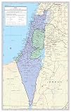
- Large Print for easy reading
- Internal 2nd order banded boundaries and their capitals. Selection of roads and rail roads, airports, ruins, and major Geographical features
- Size 24"W x 38H inches (paper)
- Made/printed in U.S.A. 2024
To gain a better understanding of what Israelis are doing on occupied Palestinian land – as well as why – watching “Roads to Occupation” is highly recommended. Through its intimate portrayal of daily life under occupation, it provides an invaluable perspective on this contentious issue that cannot be found anywhere else. To truly appreciate what is happening on the ground level between Israelis and Palestinians today, this documentary should be viewed first-hand.
Quick Recap
Also popular on Amazon

- Detailed Political Middle East Map (2003) – Reproduction of the CIA’s original political map, showing accurate country borders, capitals, and major geographical features.
- Educational & Historical Reference – Ideal for classrooms, homeschool lessons, history projects, or as a study aid for students and researchers.
- High-Resolution Printing – Crisp, clear reproduction on premium matte paper for reduced glare and professional display quality.
- Versatile Wall Décor – Great for office walls, study rooms, libraries, or as a gift for map collectors and history lovers.
- Unframed & Ready to Customize – Ships flat and unframed so you can choose the frame style that matches your décor.
Also popular on Amazon

- Regularly updated, full-color maps
- Clearly labeled Interstate, U.S., state, and county highways
- Indications of parks, points of interest, airports, county boundaries, schools, shopping malls, downtown & vicinity maps
- Easy-to-use legend
- Mileage and driving times map
Also popular on Amazon
- Large Print for easy reading
- Internal 2nd order banded boundaries and their capitals. Selection of roads and rail roads, airports, ruins, and major Geographical features
- Size 24"W x 38H inches (laminated)
- Made/printed in U.S.A. 2024
Also popular on Amazon

- Unframed 11"x13" Middle East CIA Map; This map is printed on premium 46lb matte paper with fade resistant, premium inks and includes a white border on all sides to allow for matting and framing.
- Middle East Map Spark an Interest in History; A Picture says more than a thousand words which makes these vintage reproductions a erfect additions to research and term papers.
- Educational Posters and Maps; Maps are popular tools for teachers students and researchers.
- Social Studies Classroom Decorations
- Made in USA