Quick wins for a faster PC:
Fix the driver behind crashes, sound loss and screen glitchesFind Drivers →Clear out junk files and repair common Windows errorsFree Scan →Caddo Lake is a cross-border wetland system spanning Texas and Louisiana, known for bald-cypress swamps, slow bayous, backwaters, abundant wildlife, and distinctive paddling routes. Caddo Lake State Park is the easiest official starting point for many visitors, while Hell’s Half Acre offers an approximately 8.8-mile marked loop.
The name can suggest a conventional open-water lake, but Caddo is better understood as a connected landscape of shallow channels, sloughs, wetlands, hardwood forests, protected habitat, and recreation areas. The best visit combines practical planning with respect for the wetland’s Indigenous history, private-property boundaries, wildlife, and changing water conditions.
Key takeaways
- Caddo Lake is a cross-border Texas-Louisiana wetland system of bayous, sloughs, backwaters, cypress swamps, hardwood forests, and open channels.
- The Ramsar Sites Information Service designated Caddo Lake as Wetland of International Importance Site 633 on October 23, 1993, covering 7,977 hectares.
- Caddo Lake State Park is the simplest official base for first-time visitors, with launches, canoe rentals, hiking, camping, cabins, maps, fishing, and ranger programs.
- Hell’s Half Acre is an approximately 8.8-mile marked paddling loop that usually takes three to four hours, although wind, water level, traffic, and route conditions affect the trip.
- Caddo Lake supports as many as 86 fish species and important Central Flyway habitat, but wildlife sightings—including alligators—are never guaranteed.
What is Caddo Lake known for?
Caddo Lake is known for its maze of bald-cypress-lined bayous, shallow backwaters, water-tupelo swamps, wildlife habitat, and unusually complex paddling routes. Caddo Lake consists of both river and backwater swamp, as Texas Parks and Wildlife Department explains on its Hell’s Half Acre trail page. The result is less like a conventional open-water lake and more like a connected wetland landscape that changes character from channel to channel.
Caddo Lake is also a destination for canoeing, kayaking, fishing, birding, photography, hiking, camping, and guided boat trips. The area combines recreation with international wetland recognition, federal wildlife management, state-park facilities, local communities, and deep Indigenous history.
#1 Best Overall
Is Caddo Lake in Texas or Louisiana?
Caddo Lake is in both Texas and Louisiana. The wetland crosses the state line in northeastern Texas and northwestern Louisiana, around parts of Harrison and Marion counties in Texas and Caddo Parish in Louisiana. Visitors should therefore distinguish between the lake as a cross-border system and individual access points, which may be managed by Texas state agencies, federal authorities, private operators, or Louisiana entities.
Official sources use different measurements because they describe different geographic or management contexts. The TPWD lake survey describes a 27,472-acre lake on Big Cypress Creek, including 12,712 acres in Texas, while the Caddo Lake State Park page uses a 26,810-acre figure for the waterbody accessible from the park. The figures should not be treated as contradictory measurements of exactly the same area.
| Official description | Figure | What the figure represents |
|---|---|---|
| TPWD lake survey | 27,472 acres | Lake description for Big Cypress Creek and the Cypress Creek Basin; 12,712 acres are in Texas. |
| TPWD state-park page | 26,810 acres | Waterbody description associated with the state-park access area. |
| Ramsar Sites Information Service, 1993 | 7,977 hectares | Internationally designated wetland area for Ramsar Site 633. |
| Caddo Lake National Wildlife Refuge, established 2000 | Approximately 8,500 acres | Portions of the former Longhorn Army Ammunition Plant managed for fish and wildlife conservation. |
Is Caddo Lake a natural lake?
Caddo Lake is best understood as a lake-and-wetland complex rather than a simple natural basin. Its present landscape includes slow-moving bayous, wetlands, backwaters, sloughs, bottomland hardwoods, open channels, and dense cypress stands. Water moves through the system in ways that make the boundaries between river, swamp, and lake difficult to reduce to one ordinary lake shape.
The landscape also has a human history. The National Park Service says the name “Caddo” comes from a French abbreviation of Kadohadachho, translated as “real chief,” and describes Caddo communities as occupying the broader forested, well-watered region for more than 1,000 years. Caddo Lake should not be presented as an untouched wilderness without acknowledging those Indigenous, industrial, conservation, recreational, and community layers. Read the National Park Service account of early Caddo history for that cultural context.
Do these 3 things before closing this tab:
1Repair Windows errors before they cause bigger problems2Scan for outdated or missing drivers - takes under a minute3Clear out junk files and repair common Windows errorsWhy does Caddo Lake matter ecologically?
Caddo Lake matters because its shallow, heavily vegetated waters provide habitat across several connected wetland types. The Ramsar Sites Information Service recorded Caddo Lake as Ramsar Site 633 on October 23, 1993. The designation covers 7,977 hectares and recognizes swamps, sloughs, backwaters, hardwood forests, mature bald-cypress communities, wintering waterbirds, wood-duck habitat, and mature hardwoods used by Neotropical migrant birds.
The U.S. Fish and Wildlife Service says the Caddo Lake National Wildlife Refuge was established on October 19, 2000, on portions of the approximately 8,500-acre Longhorn Army Ammunition Plant. The refuge exists to manage, conserve, and protect migratory birds and other fish and wildlife.
Rank #2

- Beautiful modern map print of Caddo Lake, Texas
- Caddo Lake poster is colored trails against a white background, made in the USA
- Show off your Caddo Lake pride, great for transplants or any Caddo Lake lover
- Caddo Lake print makes a great gift
- Printed on high quality on thick matte paper, does not come with frame
According to the U.S. Fish and Wildlife Service, Caddo waters support as many as 86 fish species, including at least 18 game-fish species. The refuge also identifies the alligator snapping turtle and Rafinesque’s big-eared bat among species considered rare or threatened under national and international laws.
What wildlife can you see at Caddo Lake?
Visitors may see bald cypress, water tupelo, Spanish moss, turtles, frogs, herons, egrets, wood ducks, warblers, other wading and migratory birds, fish, and alligators. A sighting depends on season, water conditions, location, noise, and luck. Area inventories describe habitat capacity, not a guarantee that one visitor will encounter every listed species.
TPWD’s Hell’s Half Acre information lists approximately 189 tree and shrub species, 75 grasses, 42 woody vines, and 47 animals in the trail area, along with more than 200 kinds of birds and more than 90 fish and reptiles. Those figures describe the broader trail environment rather than a checklist for a single paddle.
Alligators live in Caddo Lake State Park. Keep well away from alligators and other wildlife, never feed or corner an animal, and use binoculars or a camera with a long lens instead of approaching for a photograph.
Can you kayak or canoe on Caddo Lake?
Yes. Canoeing and kayaking are among the best ways to experience Caddo Lake’s narrow channels and quiet backwaters. Caddo Lake State Park provides launch facilities and canoe rentals, and visitors may bring their own suitable craft. The park offers access to Saw Mill Pond and Big Cypress Bayou, while experienced paddlers can connect with longer routes.
TPWD lists ten official paddling trails in the Caddo and Big Cypress Bayou area, totaling more than 50 miles. The named routes are Benton Lake, Clear Lake, Haggerty Creek, Mill Pond, Old River II, Carter’s Chute, Cathedral, Hell’s Half Acre, Old Folks Playground, and Turtle Shell. Route choice should depend on paddling experience, time available, current conditions, and whether the launch and destination are within the same management area.
What’s actually slowing this PC down?
Pick the symptom - the matching free tool is one click away.
Rank #3

- CADDO LAKE TEXAS TOPO MAP: This 1944 historic USGS topographic map documents the Caddo Lake area at 1:62500 scale in a 15-minute quadrangle format.
- HARRISON COUNTY MAP DETAIL: Covers part of Harrison County, Caddo County, and Marion County, Texas, with roads, contours, waterways, names, and woodland tint detail.
- TEXAS MAP GIFT: A thoughtful wall art gift for map collectors, local history fans, or anyone decorating a study, office, or den.
- Detailed USGS topographic map featuring elevation contours, waterways, roads, geographic names, and regional landscape detail from the official United States Geological Survey mapping series.
- Professionally reproduced from historical USGS source material and printed for display, study, office decor, home decoration, genealogy research, and map collections.
| Activity or route | Typical use | Planning consideration |
|---|---|---|
| Saw Mill Pond and Big Cypress Bayou | Shorter park-based paddle | Good starting point for visitors using the state-park launch and facilities. |
| Hell’s Half Acre | Self-guided marked loop | Approximately 8.8 miles and usually three to four hours; conditions can change the timing. |
| Other Pineywoods trails | Longer or more specialized paddling | Ten official trails total more than 50 miles, with different navigation and access requirements. |
| Guided boat or paddling outing | Interpretation and route support | Useful for visitors who prefer local knowledge, but operator availability and terms must be checked directly. |
How long is the Hell’s Half Acre trail?
Hell’s Half Acre is an approximately 8.8-mile marked paddling loop from the Mill Pond canoe and kayak launch at Caddo Lake State Park. TPWD estimates a typical float time of three to four hours, depending partly on time spent exploring the bayou, water level, and wind speed.
The route uses reflective arrow markers and passes through cypress corridors, boat roads, the Caddo Lake Wildlife Management Area, a sandy area known locally as Sandbar, and primitive campsites. Motorboat traffic, hunting seasons, narrow passages, private-property boundaries, wind, and water level can make the route more demanding than the mileage suggests.
Carry a physical or waterproof paddling map as a navigation backup. TPWD provides an official Caddo Lake State Park trails map and an interactive park trails map. A third-party waterproof paddling map can supplement those official resources, but it should not be described as an official TPWD map unless its provenance is clearly established.
Where can you launch a kayak at Caddo Lake?
Caddo Lake State Park is the most straightforward official launch point for many visitors. The park provides a boat ramp, canoe rental, maps, restrooms, camping, cabins, fishing access, and ranger programs. The Hell’s Half Acre loop begins at the Mill Pond canoe and kayak launch.
The federal refuge has separate access rules. The U.S. Fish and Wildlife Service states that recreational boats used for hunting or wildlife viewing must be removed daily, and Starr Ranch Boat Ramp is closed to motorized boats while remaining available for canoes and kayaks. Refuge rules do not automatically apply to every other part of Caddo Lake.
Private marinas and local operators may offer launches, rentals, shuttles, customized kayak or canoe delivery, and guided boat tours. Confirm current opening times, fees, parking, reservations, route access, and shuttle arrangements before relying on a private facility.
What can you do at Caddo Lake besides paddle?
Fishing, hiking, camping, wildlife watching, photography, and interpretation give non-paddlers several ways to experience the wetland. TPWD identifies largemouth bass as the most popular sportfish and reports good numbers of trophy-size bass over eight pounds. The state-park page reports more than 70 fish species, while the refuge reports as many as 86 fish species in Caddo waters; the two figures come from different official descriptions and should be retained separately.
Rank #4
- Beautiful modern map print of Caddo Lake, Texas
- Caddo Lake poster is colored trails against a white background, made in the USA
- Show off your Caddo Lake pride, great for transplants or any Caddo Lake lover
- Caddo Lake print makes a great gift
- Printed on high quality on thick matte paper, does not come with frame
Caddo Lake State Park has approximately 2.5 miles of hiking trails, 46 campsites ranging from water-only sites to full hookups, screened shelters, and historic cabins, including two ADA-accessible cabins. The park map identifies the Caddo Forest Trail, Woodpecker Hollow Trail, Pine Ridge trails, camping areas, cabins, boat ramp, canoe rental, fishing areas, and Civilian Conservation Corps features.
The Tool Desk
Outbyte Driver Updater FREEFix the driver behind crashes, sound loss and screen glitchesFind Drivers →Outbyte PC Repair FREEClear out junk files and repair common Windows errorsFree Scan →Birders should plan for quiet observation rather than guaranteed sightings. Binoculars, a long-lens camera, drinking water, sun protection, insect protection, and a dry bag for phones, maps, and spare clothing are practical additions for a multi-hour outing.
Independent reader supportYour contribution helps us test, update, and keep practical guides available for everyone.How should you plan a first visit to Caddo Lake?
- Choose a management area. Decide whether the trip will center on Caddo Lake State Park, the National Wildlife Refuge, a private marina, or a guided operator. Access rules and facilities differ.
- Match the route to the group. A park-based paddle or short interpretive visit is simpler than an extended backwater route. Hell’s Half Acre requires several hours and dependable navigation.
- Check official conditions. Review reservations, hours, entrance fees, closures, water level, weather, wind, trail-marker conditions, hunting conditions, and refuge notices immediately before departure.
- Reserve early. TPWD warns that Caddo Lake State Park can reach capacity and recommends reservations for both camping and day use. Confirm current availability on the official state-park page.
- Prepare for wetland travel. Bring a properly fitted personal flotation device, water, sun and insect protection, a map or navigation backup, a phone in a dry bag, and spare clothing protected from spray.
- Respect ownership and wildlife. Public navigability does not grant permission to use private riverbanks or adjoining private land. Keep distance from animals, avoid swimming, and leave campsites and shorelines as you found them.
What safety rules matter on Caddo Lake?
The main safety issue is not distance alone; it is the combination of confusing channels, changing conditions, boat traffic, wildlife, and mixed public and private land. Check weather, wind, water level, access notices, and marker conditions before launching. Big Cypress Bayou can have motorboat traffic, particularly during seasonal use, and surrounding property may be affected by winter duck hunting.
Swimming in the swamp is not recommended. Alligators are present in the state park, so never feed, approach, corner, or attempt to attract one. Keep children and pets close to the group near shorelines and avoid placing hands or feet into concealed water or vegetation.
Campers should buy firewood locally where it will be burned. TPWD says Harrison County is under an emerald ash borer quarantine and restricts the movement of firewood. Check the current park notice for the rules in effect at the time of travel.
Windows Errors? Fix Them Before They Spread
Repair common Windows errors and clear accumulated junk for a smoother, more stable PC - no reinstall needed.Free scan · no reinstallCrashes, No Sound, or Screen Glitches?
Random freezes, missing sound and display glitches usually trace back to one bad driver. Find and replace yours safely.Free scan · under a minuteIs Caddo Lake worth visiting?
Caddo Lake is worth visiting for travelers who want a distinctive wetland rather than a conventional recreational lake. The strongest reasons are the cypress-and-bayou scenery, accessible paddling, bird and wildlife habitat, fishing, state-park camping, and the chance to understand a landscape shaped by Indigenous history and modern conservation.
Best Value
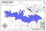
- 16" x 24" or 20" x 30" Full Color Map Reproduction
- Plotted on Heavy Weight Archival Matte Paper or Fine Art Canvas. Canvas has an additional one inch white border all the way around for mounting if needed.
- This map is shipped safely in a map tube!
Caddo Lake is less suitable for visitors seeking a simple beach day, predictable open-water boating, or a route that requires no navigation. The wetland rewards slower travel and preparation. A first visit is easiest from Caddo Lake State Park, while experienced paddlers can use the broader trail network or arrange a guided outing after confirming current access.
Planning links and responsible conservation
Use TPWD’s official park page and maps for current access information, the U.S. Fish and Wildlife Service for refuge rules, and the Ramsar record for international wetland context. The Caddo Lake Institute is a documented conservation and education organization; any donation, membership, or partnership should be evaluated directly rather than assumed to carry affiliate status.
Frequently Asked Questions
Is Caddo Lake in Texas or Louisiana?
Caddo Lake is in both Texas and Louisiana, across northeastern Texas and northwestern Louisiana. Caddo Lake State Park, the easiest official starting point for many visitors, is at 245 Park Road 2 in Karnack, Texas.
Free tools Windows power users keep installed
One-click scans. No signup required.
Can you kayak or canoe on Caddo Lake?
Yes. Caddo Lake State Park provides canoe and kayak access, including the Mill Pond launch used for the approximately 8.8-mile Hell’s Half Acre loop. The federal refuge has separate access rules, including a nonmotorized restriction at Starr Ranch Boat Ramp.
How long is the Hell’s Half Acre trail?
Hell’s Half Acre is approximately 8.8 miles long and usually takes three to four hours to float. Water level, wind, time spent exploring, motorboat traffic, hunting conditions, and navigation can change the required time.
Are there alligators at Caddo Lake?
Yes, alligators live in Caddo Lake State Park and may occur elsewhere in the wetland. Visitors should keep their distance, never feed or corner wildlife, and avoid swimming in the swamp.
The Bottom Line
Caddo Lake is a cross-border wetland system best explored slowly by canoe, kayak, small boat, or guided tour. Start with Caddo Lake State Park, carry official map information plus a navigation backup, check conditions and rules before launching, and treat the cypress swamp as protected wildlife habitat rather than an ordinary lake.
Quick Recap
Product prices and availability are accurate as of the date/time indicated and are subject to change. Any price and availability information displayed on Amazon at the time of purchase will apply.