
Free tools Windows power users keep installed
One-click scans. No signup required.
Some links on this page are affiliate links: if you buy through them we may earn a commission, at no extra cost to you.
The Canada – US border, officially known as the International Boundary, is the longest international border between two countries. More than 8,800 km long, the border occupies the parts of Alaska, British Columbia, and Yukon.
Prior to 9/11, crossing the border was relatively easy. But after the 9/11 attacks, life changed. And even more for the people living on the border.
This documentary takes a look at the unexpected cultural, social, economic, and political fallout following the 9/11 attacks. It also explores the growing concern that border security and the invasion of privacy has gone too far.
PC Slower Than It Used to Be?
A free scan shows the junk files, broken settings and background clutter dragging Windows down - then fixes them in one click.Free scan · Windows 10 & 11Crashes, No Sound, or Screen Glitches?
Random freezes, missing sound and display glitches usually trace back to one bad driver. Find and replace yours safely.Free scan · under a minuteThere are more than 100 legal land border crossings between the two countries. Of them, 26 take place at a bridge or tunnel. Only two are one way-crossings.
Quick Recap
Also popular on Amazon

- Each Poster 18" tall x 29" wide
- Updated
- High-quality 3 MIL lamination for added durability
- Tear Resistant
Also popular on Amazon

- Instant Application with Flat Shipping Package – Our travel map stickers arrive in perfect condition, packed securely between sturdy cardboards—no folds, wrinkles, or creases. Just peel and apply your decals instantly and smoothly, right out of the package. Applicable to flat surfaces with no bumps or protrusions; not suitable for granular or uneven surfaces.
- Fade-Resistant & Waterproof – Upgraded with long-lasting ink and a special coating, our state stickers resist fading for over 2 years, even in harsh weather conditions. Durable, vibrant, and built to withstand all your adventures.
- Effortless Use – Peel & Apply – Each set includes 47 decals for the 50 U.S. states and 11 decals for the 13 Canadian provinces, designed for easy peeling—apply one state at a time as you travel.
- Perfect Dimensions – The USA and Canada map sizes are both 11 ⅘“ x 15 ¾” (400 x 300 mm), making them a perfect fit for most RVs, campers, SUVs, and motorhomes. Some decals may require minor trimming before application—please refer to the details below.
- Capture Your Journey Across Borders & States – Preserve your travel memories with our super sticky RV state sticker map. Perfect for documenting your cross-country and cross-border road trips in the USA and Canada.
Also popular on Amazon

- National Geographic Canadian Rockies Map: Destination Map
- maps
- Natl Geographic Society Maps
- Light shade
Popular on Amazon
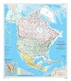
- 34 x 39 inches. Laminated. Flat map, tubed for shipping.
- This map shows North America at a scale of 1: 10 000 000. The map is a general reference map giving detailed coverage of populated places, transportation routes and the drainage network. Land areas are colored to represent individual countries and dependencies. The map sheet has three inset maps showing the Aleutian Islands (Alaska), Hawaii and the North America relief with significant mountain elevations. There is also a table of road mileages between major cities.
- Scale 1:10,000,000
Product prices and availability are accurate as of the date/time indicated and are subject to change. Any price and availability information displayed on Amazon at the time of purchase will apply.
Independent reader supportYour contribution helps us test, update, and keep practical guides available for everyone.





Say something about this film