Some links on this page are affiliate links: if you buy through them we may earn a commission, at no extra cost to you.
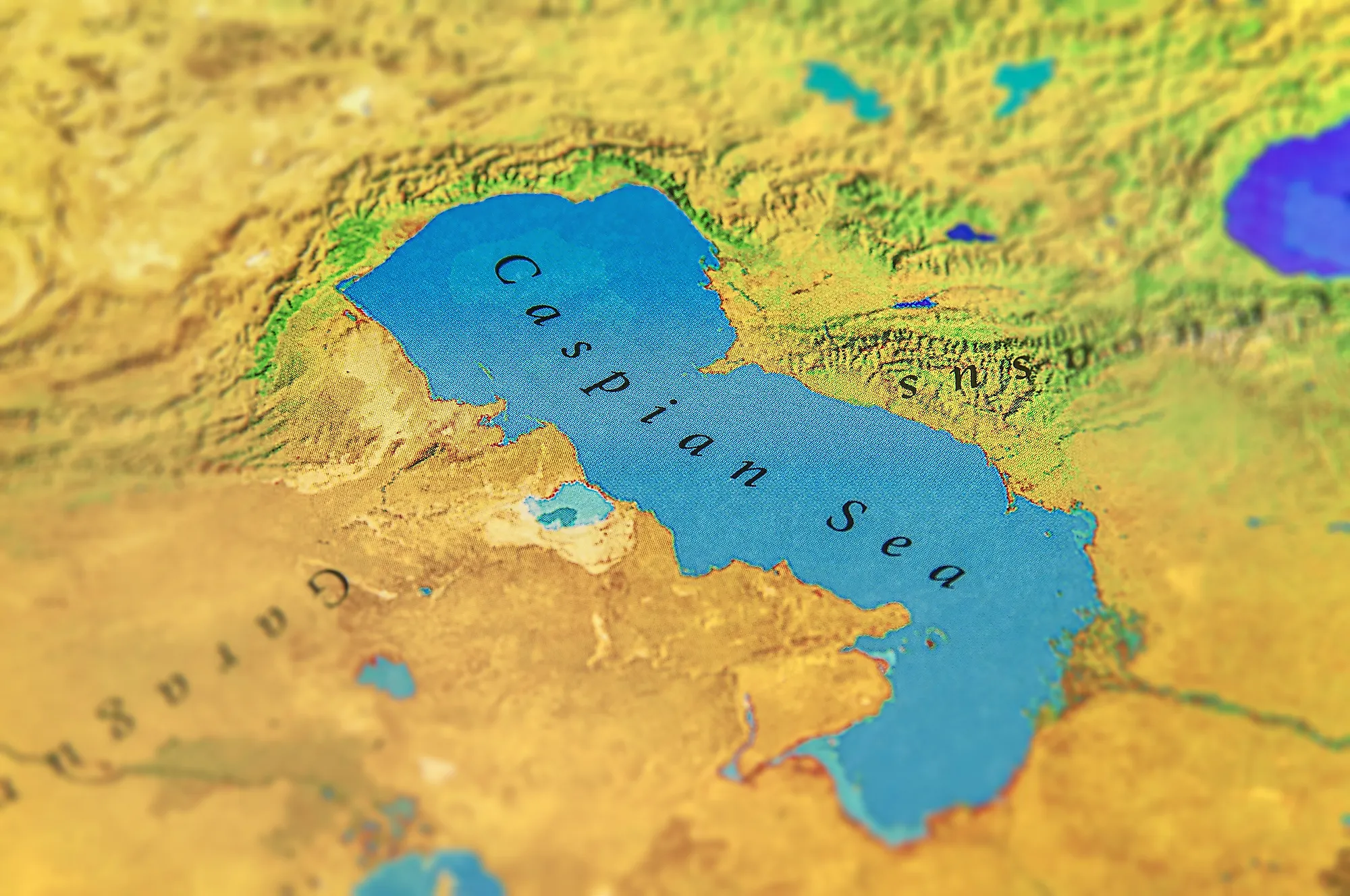
The Caspian Sea is the world’s largest lake. Yes, it shares some characteristics with a sea, namely salinity and the fact it has an ocean basin below sea level. But it is a sea. The lake, also called world’s largest inland body of water, lies between Europe and Asia, east of the Caucasus, west of the broad steppe of Central Asia, south of the fertile plains of Southern Russia, and north of the Iranian Plateau.
The Caspian Sea covers 143,550 square miles and has a volume of 19,000 cubic miles. Stretching for nearly 750 miles from north to south, it has an average width of 200 miles.

The main freshwater inflow is Europe’s longest river, the Volga, which enters at the shallow north end. Here are some facts about the largest lake in the world.
Long history and many derivations of the name
There is a long-standing theory behind the name Caspian Sea. It refers to the Caspi people in the 6th century BC, who many believe were the native inhabitants of the region.
#1 Best Overall
There is no much literature on the culture of the Caspi, but they have been mentioned in Egyptian, Greek, and Persian chronicles.
Another historic mention is the fabled Gates of Alexander, or Caspian Gates. They are part of the lore and history of Iran and the Caspian Sea region. According to history, the Caspian Gates were barriers to have been erected by Alexander the Great in order to keep barbarians from invading the territory to the South.
As for the many names, the Iranian city Qazvin is the original regional name for the Caspian Sea. It was named Bahr Qazvin in antiquity by local Arabs, translating to Sea of Qazvin which was corrupted to Caspian later on.
How salty it is?
The salinity of the Caspian sea is about 12.8 parts per thousand on average, going from a mere 1 part per thousand near the Volga outlet. It can get up to 200 parts per thousand in the Kara-Bogaz-Gol, an area where intense evaporation occurs.
This is why many experts say it has characteristics of a sea. But because it is an inland body of water, it cannot be classified as sea. In the open sea, distribution of salinity is markedly uniform, increasing by only 0.1 to 0.2 part per thousand from the surface to the bottom.
The Seabed of Caspian Sea
The seabed of the Caspian Sea is the 2nd lowest natural relief depression on Earth. It is varied in depth and sub-surface features.
The North Caspian region has an average depth of only 10 meters. Yet, the South is deeper with an average depth of 1,000 meters. There is a region in the south where the depth is 1,023 meters, making the lake the second lowest natural relief depression. The first, is Lake Baikal in Southern Siberia, with depth of 1,180 meters.
Free tools Windows power users keep installed
One-click scans. No signup required.
Rank #2
- BUILD CULTURAL AWARENESS: Perfect for the classroom! This map is the perfect tool to help students understand the political complexity of the Caspian region.
- UNIQUE NATIONAL GEOGRAPHIC PRODUCT: This map offers a unique view of nations around the Caspian Sea.
- USE WITH DRY ERASE: Highlight areas on the map and wipe off when you're done on this glossy laminate finish
- DURABLE MATERIAL: With laminated product, your map is protected from tears, folds and liquids
- ICONIC CARTOGRAPHY: National Geographic's maps are the standard others are measured against. You can count on this product having the highest quality content and display in the industry.
Are there any islands?
Here is a fun fact, the Caspian Sea contains as many as 50 islands. Of course, most of them are small, but there are also large islands like the Chechen, Morskoy, Zhiloy, Ogurchin, and more.
Home to unique species of marine fauna
The Caspian Sea is an inland lake, home to many species of indigenous marine flora and fauna. According to some archaeological research, there is evidence of dolphins, porpoises, and whales in the Sea around 50,000 to 100,000 years ago. Some rocks and cave arts date to the same period, indicating reliefs of dolphins and whales.
Some species unique to the sea have been prefixed with the term Caspian, for example, Caspian gull, Caspian turtle, Caspian tern, Caspian seal, and many more.
Species from the Caspian Sea often reach other water bodies where they become invasive because of the internal currents. For example, the Zebra mussel has spread to nearby coasts.
Five Countries share territorial claim
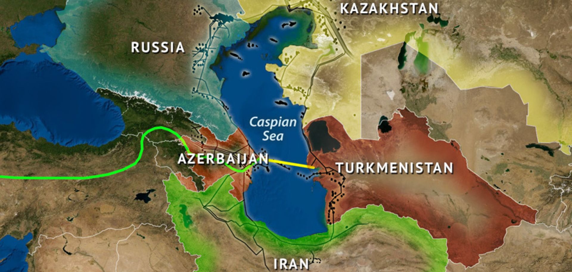
The five countries that share territorial claim over the Caspian Sea are Azerbaijan, Russia, Turkmenistan, Kazakhstan, and Iran. They all share the natural heritage of the lake. No matter of the political and social diversity, people in the region share a common concern for the Caspian.
The Caspian Summit is a head of state-level meeting of the five littoral states. The fifth such summit took place on August 12, 2018, in the city of Aktau.
Rank #3

- Hand-colored copperplate engraving from 1810 depicting the geographic and topographic features of the region between the Caspian and Black Seas, including Armenia and Central Asia.
- Historical map reproduction showing political borders, relief details, and regional geography of Eastern Europe and the Caucasus during the early 19th century.
- Made-to-order wall art print ideal for history enthusiasts, geographers, collectors, and anyone interested in vintage maps and historical cartography.
- FINE ART PRINT QUALITY: Printed on heavyweight 230gsm matte paper with archival giclée inks for crisp detail, rich tonal depth, and long-lasting display quality suitable for home, office, or gallery-style framing.
- PRINTED IN THE USA: Professionally printed on heavyweight matte paper and carefully packaged in a durable protective tube for safe delivery. Many sizes fit widely available standard frames. Each artwork is digitally restored to reduce age-related imperfections while preserving the historic texture, detail, and character of the original map.
Large oil reserves
Maybe one reason why each of the five countries is concerned with the sea is because the Caspian has large oil reserves. There are several rigs in the region. Oil and gas from contribute to 10% of the five countries and 40% of all their exports.
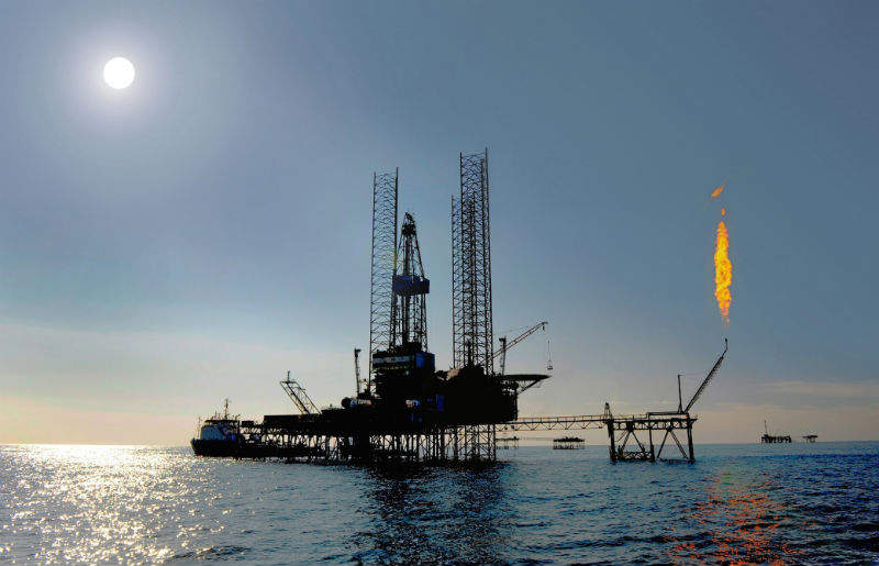
In that spirit, Iran is ranked 2nd in the world in terms of reserves, with enormous supply of crude oil. Russia is second in the world in oil and natural gas production. The average output from the Caspian Sea is 1.5 million barrels per day. Kazakhstan produces the most out of the five countries, with 55% of the output. Azerbaijan is second with 20% of the output.
Caviar is farmed from the Caspian Sea
Caviar is one of the most expensive delicacies enjoyed around the world. Did you know it is farmed from the Caspian Sea? It is a major site of roe farming. Caviar is salt-cured roe of eggs of certain fish species, including salmon and sturgeon.
Because roe farming is very lucrative, it has led to overfishing. Farming targets the reproducing females of the species. In the past several years, there have been many bans on fishing in the region. Yet, the practice continues illegally.
Quick Recap
Product prices and availability are accurate as of the date/time indicated and are subject to change. Any price and availability information displayed on Amazon at the time of purchase will apply.

